Satellite of LAPAN-A3/LAPAN-IPB was Launched in India
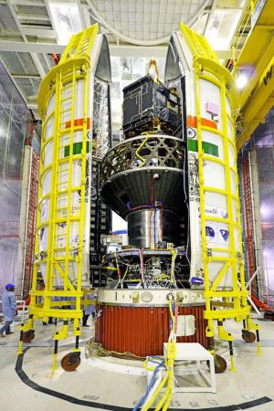
After being delayed for 12 days, finally Wednesday (22/6), the latest generation of the experiment satellite of LAPAN-A3/LAPAN-IPB was launched from Bandar Antariksa of Sriharikota, India. This satellite of LAPAN-A3/LAPAN-IPB was launched using the rocket of launcher of PSLV belonged to ISRO-India together with 21 satellites coming from various countries.
The satellite of LAPAN-A3/LAPAN-IPB was developed based on the collaboration of LAPAN and Bogor Agricultural University in order to improve the knowledge, the skill, the design and the development of the satellite by the Indonesian nation to be able to master the outer space technology, both for experimental and operational purposes. LAPAN was responsible in designing, producing, testing, launching, to receiving the satellite data. IPB was responsible in developing algorithm, utilization, and application of satellite data.
According to Head of LAPAN, Thomas Djamaluddin, the design, production, and testing of LAPAN-A3/LAPAN-IPB were conducted by Indonesian expert with the facilities in Indonesia. The satellite production used the existing facilities in LAPAN and the testing with the facilities of Indonesian Institute of Sciences (LIPI).
The satellite of LAPAN-A3/LAPAN-IPB had the main function to do the monitoring of the agricultural land of Indonesian food through the imaging of pushbroom of 4 multispectral channels (Red, Green, Blue and Near-Infrared) with the resolution of 18 meters with a width of coverage of 108 km and the visible camera with high resolution (3.5 meters).
Other than that, like the previous generation of satellites (LAPAN-A2/ORARI), the satellite of LAPAN-A3/LAPAN-IPB was also equipped with the technology of Automatic Identification System (AIS) which served to monitor the global sea traffic. If LAPAN-A2 orbited the earth around the equator, LAPAN A3/LAPAN-IPB orbited the earth across the north pole and the south pole of the earth (polar orbit), so it would complement the monitoring of the data traffic of ships from the satellite. The scientific mission of the satellite was to measure the earth’s magnetic field.
Compared with the previous experimental satellite, LAPAN-A3/LAPAN-IPB weighed 115 kilograms (kg) or 39 kg heavier than LAPAN-A2/ORARI. This weight gain was important in making the operational satellite of the earth observation weighing of 1,000 kg.
The satellite development program proved the ability of Indonesian human resource in designing the micro-size satellite (microsatellite) model with the weight of 100 kg. The satellite development was also the effort to realize the development of the economic competitive advantage. The satellite technology would support the accuracy of the data in planning for the planting of paddy fields which would be implicated directly on the improving of the food security. This of course would help the government in determining the various policies related to food, for example related to the rice import.
After the launching of the satellite of LAPAN-A3/LAPAN-IPB, on 25-26 October 2016 in IPB would be held the 3rd symposium with the theme of “The 3rd International Symposium on LAPAN-IPB Satellite, For Food Security and Environmental Monitoring 2016”.
This International Symposium would focus on improving the use of satellite technology in the fields of agriculture, forestry, climate change, and marine resources in terms of food security. This would be related with the estimation of agricultural land and the productivity of marine resources, as well as the system of Monitoring, Reporting and Verification (MRV) from the program of Reducing the Emission from Deforestation and Forest Degradation (REDD). Other than that, this symposium was to prepare and complete the chain of data processing of the existing environmental satellite and the use of LISat – the data from upstream to downstream locations selected in accordance with the study of focus. The scope of this symposium included four domains (field of area) to support the food security and the environmental monitoring as follows: the agriculture, the marine and fisheries, the forest and climate in terms of the beneficial use of satellite technology.
Vice President of RI, Jusuf Kalla, had an opportunity to “watch together” the satellite launching together with the Minister of Research, Technology and Higher Education of RI, Mohamad Nasir, Rector of IPB, Prof.Dr. Herry Suhardiyanto, and Vice Governor of West Java, Deddy Mizwar. This watching together was conducted around 10:00 WIB as well as inaugurated the opening of the development of the maritime monitoring system based on the science and technology for aeronautical and astronautical, in the Aviation Technology Center, National Institute for Aeronautics and Astronautics (Lapan), in Jalan Raya Lapan Rumpin, Bogor. The Vice President conveyed that with this technology we should be able to produce faster, better and cheaper results.(dh)